In a recent post, I made my first pass at World Map Generation Tables. Over the last day or two, I finally put in time to get out some paper and roll some dice. I figure I’ll document that process a little for anyone who’s unfamiliar with this method of random map generation.
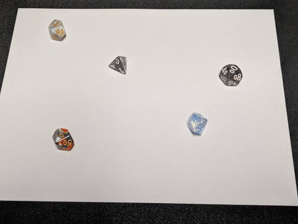
First thing, I decided how many continents I wanted my world to have. I settled on four. So, I took four d10s (or d% in the picture) to determine how big those continents would be. I also dropped a d4 in there to decide on the world’s overall environment per the Global Environment table. Note that my table has rows for up to 8, with each increase in die type offering more exotic world possibilities. I wanted something reasonably Earth-like, so I stuck with just the d4.
From there, I marked the undeveloped continent locations on my global map sheet and started rolling out the individual continents. The SE continent was the first one I worked on, so I’ll give it as the initial example.
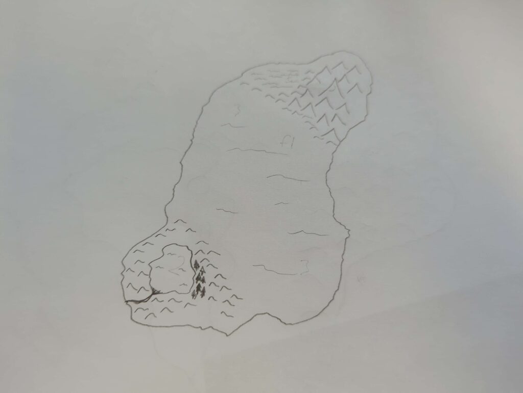
For rolling out my continents, and the details on them, I had to decide on how many dice to roll for the various features. For this round, I decided on a basic formula of “take the parent roll, divide by two, round up.”
In concrete terms, this means I took this continent’s roll of 7 and rolled 4 dice on the Elevation Features table for continents. This resulted in two valley rolls, a body of water, and a mountain region. Halving again, I rolled two dice to identify Flora/Fauna Features. The net result, per the rough map above, is a large desert valley dividing a mountainous area (with nearby well-vegetated area) and a sizable body of water set in the hills at the other end of the continent. Obviously, some creative interpretation was utilized to put these pieces together, but the process was very quick and created something that could make for interesting exploration and storytelling.
I did this same process for the other three continents. The nice thing about the math I used for deciding on how many feature dice to roll is that it guarantees a usable number of options, so even the tiny island continents were guaranteed at least one elevation feature and one flora/fauna feature. The largest continent, on the other hand, had five elevation features and three flora/fauna features.
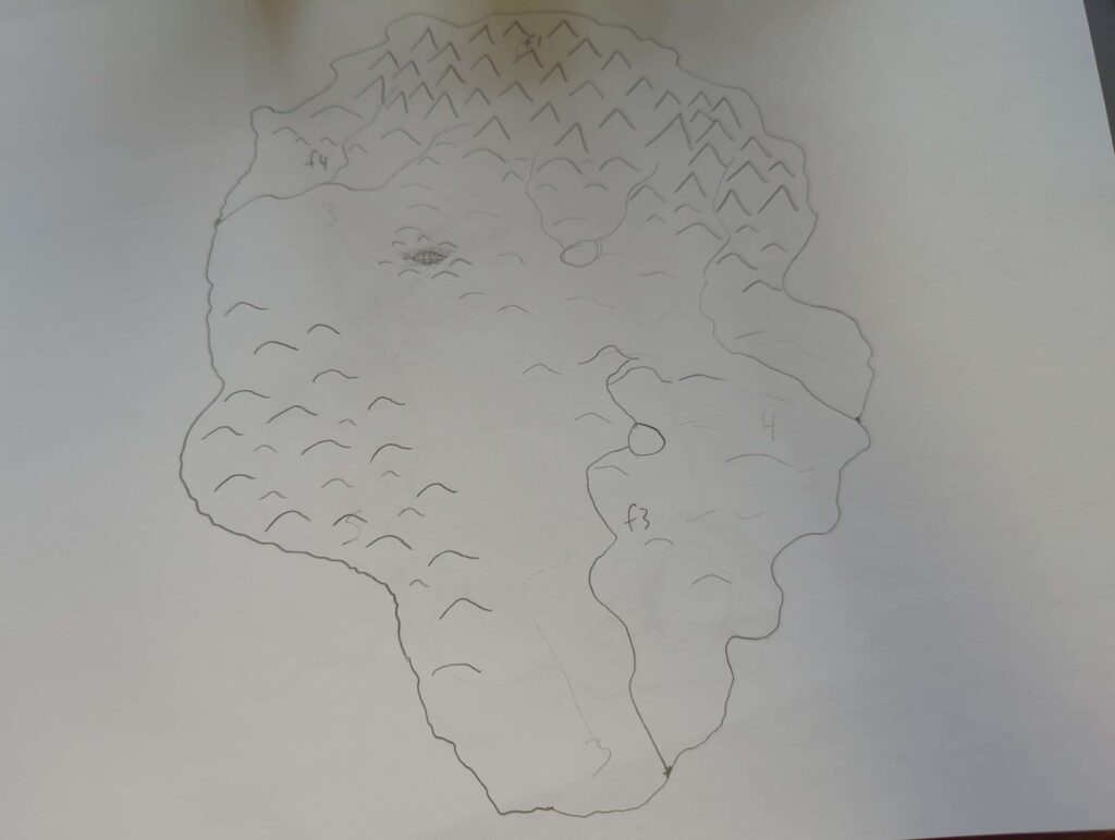
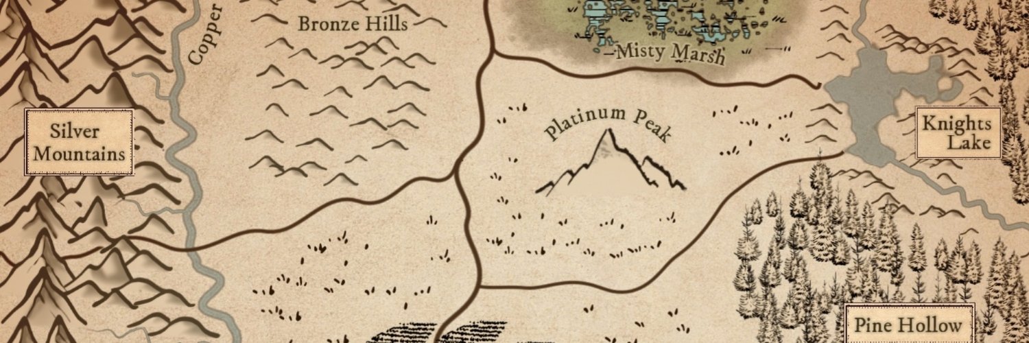
That largest continent is the one I decided to zoom in on and develop the region. For this region, I also decided to roll on the continental special features table and got an impact crater from a celestial object. This region is where I’ll plan to start my emergent world building through hexcrawls and solo play. So, once the region was mapped, I decided that the NW area of the continent would be my starting region.
Here, I got a lot less scientific in determining how many locations to create. I opted to roll a couple of times from the regional tables for elevation and flora/fauna variations from what was determined at the continental level. I added a few settlements from the settlements table until it felt like there was enough to warrant exploration and did the same with the military structures. I may add some guidelines on “how many settlements should a region ideally have?” but I mostly just intuited from the continental rolls what felt appropriate for the flora/fauna levels and other features.
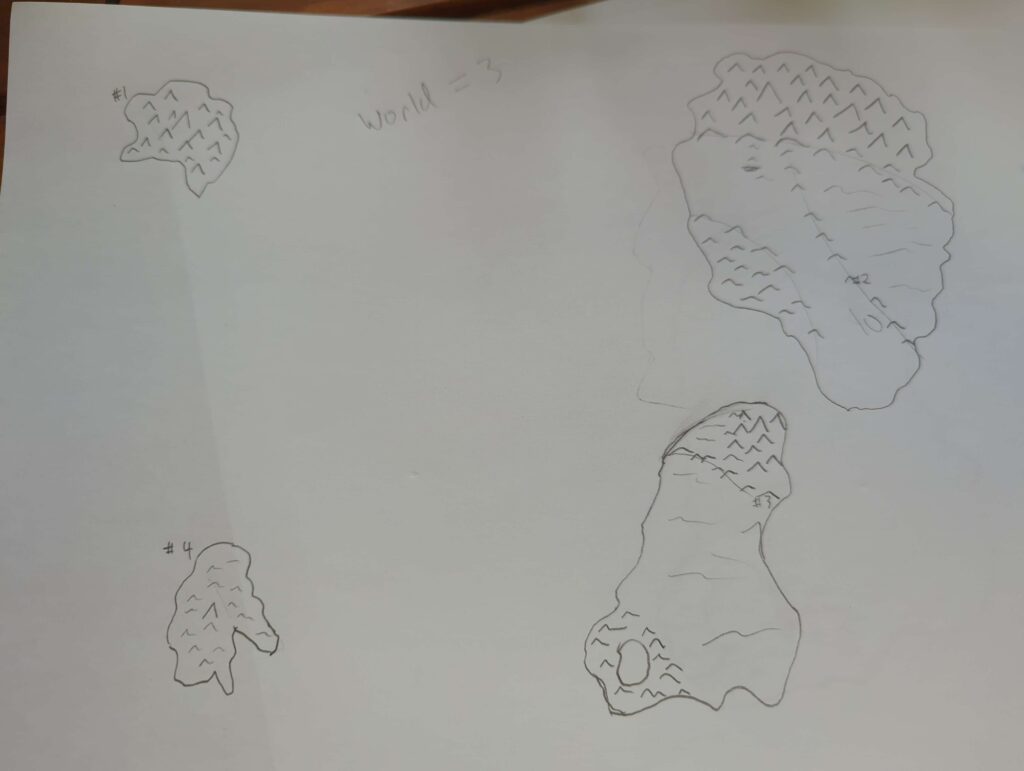
Finally, it was time to put the continents together on the single page world map. With these being hastily drawn (and my not being a refined cartographer just yet), they’re not perfect reflections of the other work, but they work as placeholders until I start to develop the regions. Ultimately, once the world is better established, it would be ideal to remake these maps in a digital medium where the work at one scale can be copied directly into a map of another scale, or at least copied in such a way to ensure better consistency between the scaled maps.
And with that, I now have a world map with four continents, one of which with detail down to the regional level. My tables have room for improvement, I’m sure, but I’m not sure yet what I want those improvements to be. Further use will help me dial them in, I think. I also desperately need to get some name generators in order because that’s easily the hardest part of any creative endeavor.
But now, I can switch from top-down creation to bottom-up development. I’ll start a character in one of the towns from the defined region, which will cause me to develop that town’s shape, key figures, and so on. From there, I can build out to what’s happening around the town and the region at large. I wouldn’t be surprised if that Fury Crater has at least one cult hovering around it.
1 thought on “Rolling a World”
Comments are closed.